佳礼资讯网

 找回密码
 注册

ADVERTISEMENT

楼主: xijiayu

北爱上山下海(新加Mourne Mountains照片)

[复制链接]
 楼主| 发表于 18-9-2007 05:26 PM | 显示全部楼层
离开Gaint's Causeway,继续前往North Coast。这是个风景优美的区域,也是北爱第一海边度假胜地。那里拥有北爱比较象样的沙滩,是许多人露营的天堂。这次我安排了在Portrush和Portsteward这两个小镇作短暂停留。只可惜整个下午的天气不好,下起小雨,让我无法享受夏天的阳光。

在前往Portrush的双层巴士上拍摄的沿途小镇风光。


14th century's Dunluce castle。


靠近Portrush的Whiterock。


Portrush镇的West Strand。


Portrush镇街道景色。


距离Portrush不远的Portsteward镇。


回复

使用道具 举报


ADVERTISEMENT

 楼主| 发表于 18-9-2007 05:26 PM | 显示全部楼层
Portsteward的The Strand。这里一带是人们进行水上活动的最佳场所。The Strand的沙滩拥有好几公里长,放眼望去相当壮观!


The Strand目前拥有许多豪华的度假屋,每间的价格相信都不少过50万英镑。


离开Portsteward后,我继续前往North Coast的第一大镇,Coleraine。Coleraine坐落在Bann River旁。


市内有一些古老的建筑物。


也有一条繁忙的商业街道,街上有许多商店和餐厅。


居住在North Coast一带的居民,每逢周末纷纷选择到Coleraine来购物。我的学校的行政中心也位于Coleraine。

-待续-


北爱 夏
28/8/2007 1924
回复

使用道具 举报

 楼主| 发表于 18-9-2007 05:27 PM | 显示全部楼层
参观过Coleraine后,最后一站是Londonderry。我乘坐回到火车站,乘坐前往Londonderry的列车。


一路上,经过乡区和海边,我在火车内拍摄了些照片。海边沙滩上的游客向我们挥手示好。


对面的另一端是爱尔兰共和国。


到达Londonderry市,拍摄流经市中心的Foyle river两岸景色。


双层楼的Craigavon Bridge。桥的顶层是给通往东岸的车子通行,底层给通往西岸的车子通行。


回复

使用道具 举报

 楼主| 发表于 18-9-2007 05:28 PM | 显示全部楼层
Londonderry,又名Derry,是北爱尔兰第二大的城市。关于这个城市最早的记载,要追踪到六世纪(521-597)时的记录。Derry的名词原自爱尔兰岛出产的一种大麦。在18-19世纪,Derry港口成为爱尔兰移民前往北美的重要启航点。今天,这些移民都多数在美国的New Hampshire州居住。


目前市内最重要的历史古迹是一个围绕市内一周,长达1.5km的历史城墙,The City Walls。


The Walls were built by The Honourable The Irish Society as defences for early seventeenth century settlers from England and Scotland - the settlement was a plan of Plantation by James I. The building of the city was financed by the trade Guilds of the City of London and work began in 1613 and finished in 1618 under supervision of Sir Edward Doddington of Dungiven. The prefix London was thus added to the name of the city and the city of Londonderry became the jewel in the crown of the Ulster Plantations. (Derry Visitor Guide 2007)

The City Walls原本拥有四个gate(Shipquay, Ferryquay, Bishop和Butcher gates),后来又添加了三个(Magazine,Castle和New gates)。这是其中一个gate,通往城中城(inner city)。


Inner city里有个Tower museum。


还有其它古老建筑物。


在城墙上拍摄的照片。


城墙旁的Guildhall。


城墙上的cannon。


城墙上看市内街道景色。


回复

使用道具 举报

 楼主| 发表于 18-9-2007 05:35 PM | 显示全部楼层
我在市内逛逛,沿着河边寻找我的大学在这里的另一个campus(Magee Campus)。

沿途中拍摄的市景。


规模庞大的中餐馆。


Foyle river的黄昏景色。


河上游艇。


找到Magee Campus了。


校园景色。


Main administration building。


Student Union。


搞什么活动?


回复

使用道具 举报

 楼主| 发表于 18-9-2007 05:37 PM | 显示全部楼层
参观完我的学校,我也得回去火车站,乘搭晚间20:40的列车回Belfast。


临走前拍摄的Londonderry黄昏景色。


我的列车抵达了。


回程中。


结束一天的Antrim Coast和North Coast之旅,到达Jordanstown火车站后已经是深夜十一点多了。

-完-


北爱 夏
29/8/2007 2131

ps: 下次旅程:Mourne Mountains
回复

使用道具 举报

Follow Us
发表于 18-9-2007 08:10 PM | 显示全部楼层
朋友,你在北爱得吗?

我去过BELFAST,可是没有去过DERRY,下次一定要去看看。。。
回复

使用道具 举报

发表于 18-9-2007 08:13 PM | 显示全部楼层
原帖由 xijiayu 于 18-9-2007 05:25 PM 发表
最终,到达我的第一个目的地。

http://i108.photobucket.com/albums/n13/xijiayu/IMG_1939.jpg

http://i108.photobucket.com/albums/n13/xijiayu/IMG_1940.jpg

http://i108.photobucket.com/albums/n1 ...

那些石头是自然形成的,对我来说真的很特别。。。
我朋友看了照片也不相信是自然的,认为是人工做的。。。
回复

使用道具 举报


ADVERTISEMENT

 楼主| 发表于 19-9-2007 12:33 AM | 显示全部楼层
原帖由 我是如花 于 18-9-2007 08:10 PM 发表
朋友,你在北爱得吗?

我去过BELFAST,可是没有去过DERRY,下次一定要去看看。。。


是的 。Londonderry比Belfast漂亮,但小很多。

原帖由 我是如花 于 18-9-2007 08:13 PM 发表

那些石头是自然形成的,对我来说真的很特别。。。
我朋友看了照片也不相信是自然的,认为是人工做的。。。


那些石头据说是由火山溶岩冷却后形成的,照片看还不错,但到那里看了其实没什么特别,至少让我觉得有点失望。
回复

使用道具 举报

 楼主| 发表于 24-9-2007 03:35 AM | 显示全部楼层

Walking in the Mourne

Mountains of Mourne

by William Percy French (1854 - 1920)

Oh, Mary, this London's a wonderful sight,
Wid the people here workin' by day and by night:
They don't sow potatoes, nor barley, nor wheat,
But there's gangs o' them diggin' for gold in the street
At least, when I axed them, that's what I was told,
So I just took a hand at this diggin' for gold,
But for all that I found there, I might as well be
Where the Mountains o' Mourne sweep down to the sea.

I believe that, when writin', a wish you expressed
As to how the fine ladies in London were dressed.
Well, if you'll believe me, when axed to a ball,
They don't wear a top to their dresses at all!
Oh, I've seen them meself, and you could not, in thrath,
Say if they were bound for a ball or a bath
Don't be startin' them fashions now, Mary Machree
Where the Mountains o' Mourne sweep down to the sea.

I seen England's King from the top of a 'bus
I never knew him, though he means to know us:
And though by the Saxon we once were oppressed,
Still, I cheered—God forgive me—I cheered wid the rest
And now that he's visited Erin's green shore,
We'll be much better friends than we've been heretofore,
When we've got all we want, we're as quiet as can be
Where the Mountains o' Mourne sweep down to the sea.

You remember young Peter O'Loughlin, of course
Well, here he is now at the head o' the Force.
I met him to-day, I was crossin' the Strand,
And he stopped the whole street wid wan wave of his hand
And there we stood talking of days that are gone,
While the whole population of London looked on;
But for all these great powers, he's wishful like me,
To be back where dark Mourne sweeps down to the sea.

There's beautiful girls here—oh, never mind!
With beautiful shapes Nature never designed,
And lovely complexions, all roses and crame,
But O'Loughlin remarked wid regard to them same:
'That if at those roses you venture to sip,
The colour might all come away on your lip,'
So I'll wait for the wild rose that's waitin' for me
Where the Mountains o' Mourne sweep down to the sea.

-------------------------------------------------

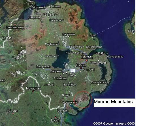
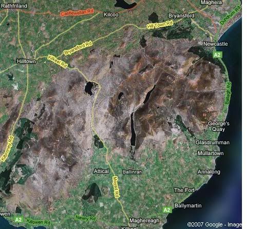
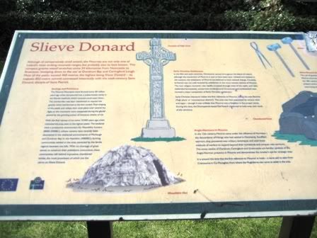
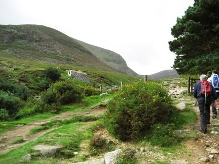
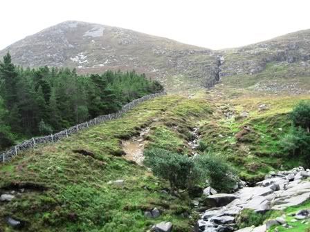
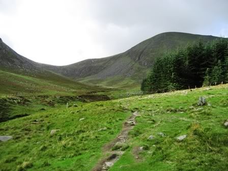
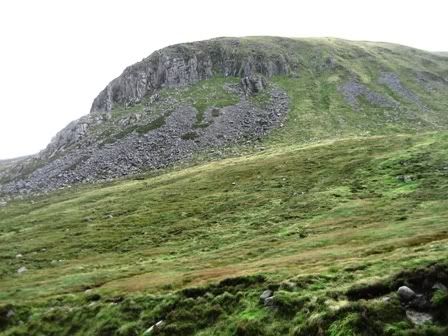
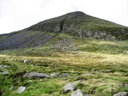
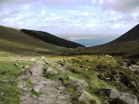
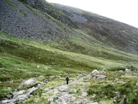
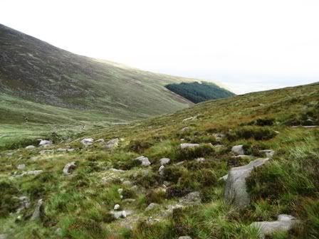
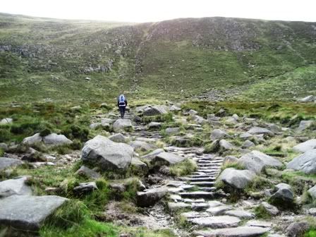
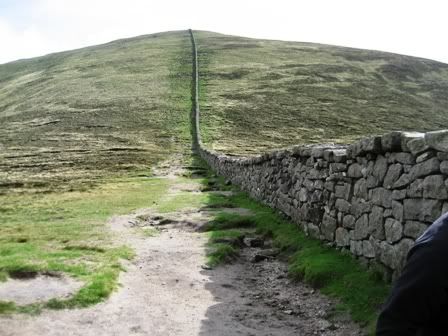
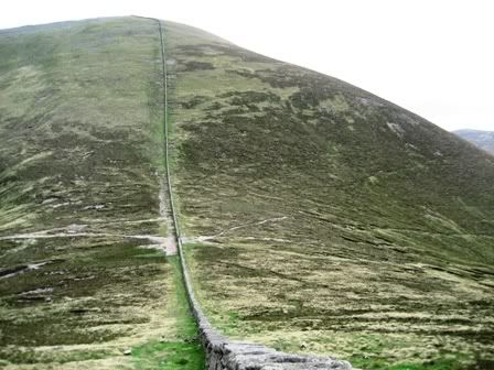
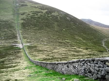
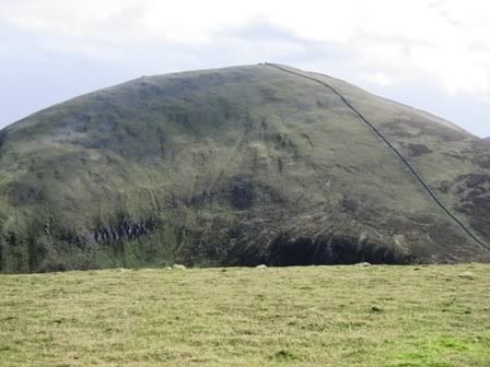
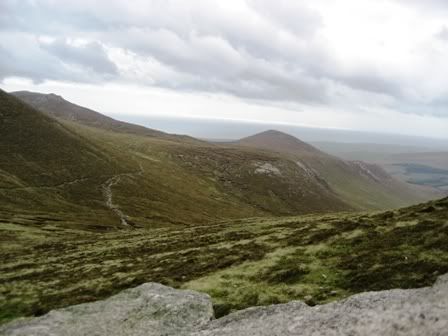
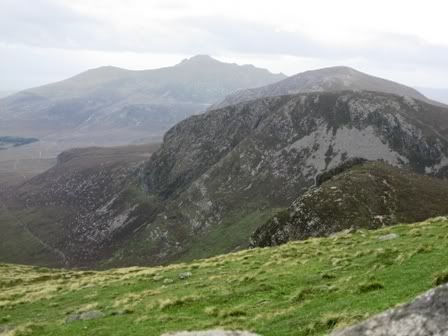
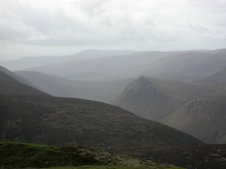
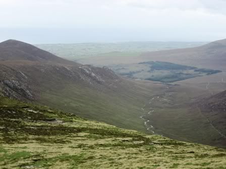
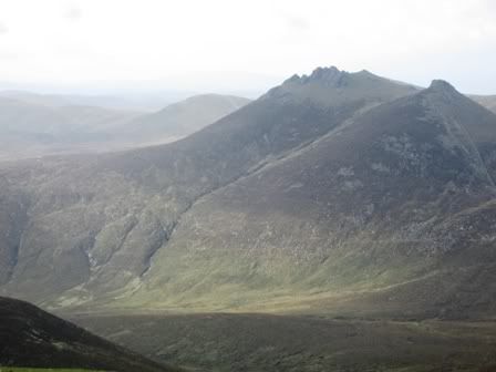
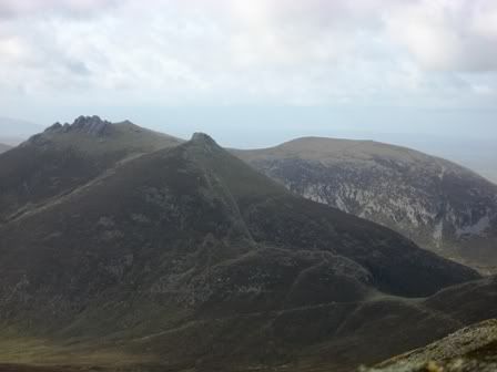
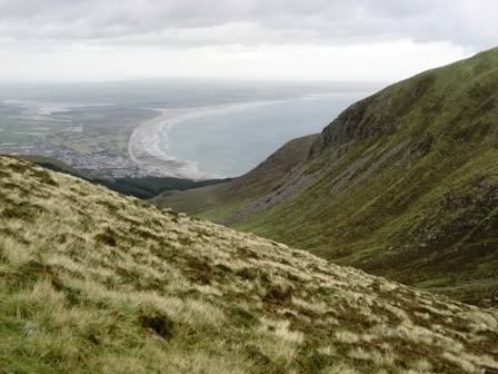
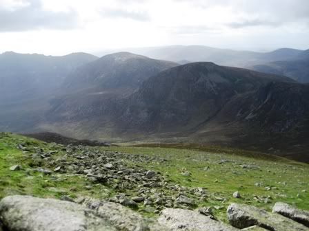
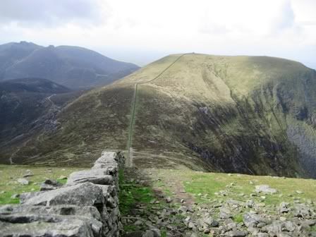
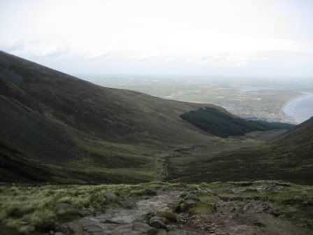
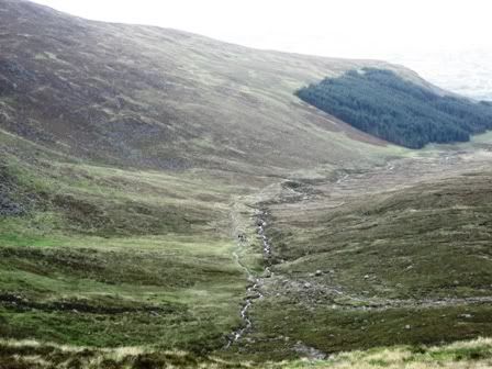
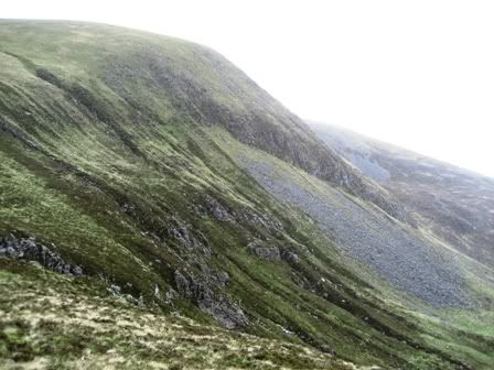
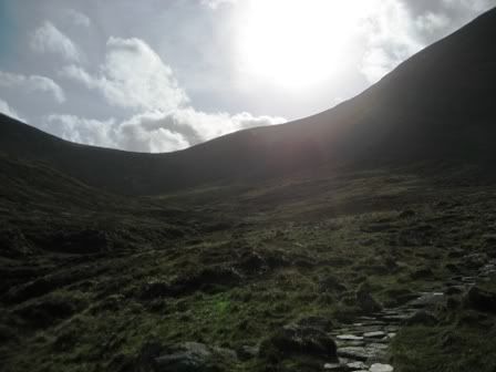
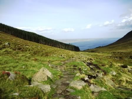
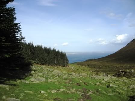
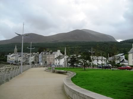
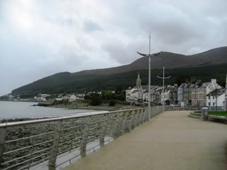
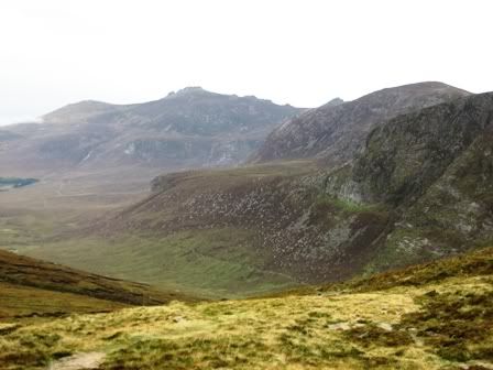
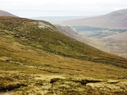
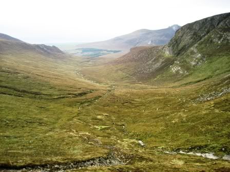
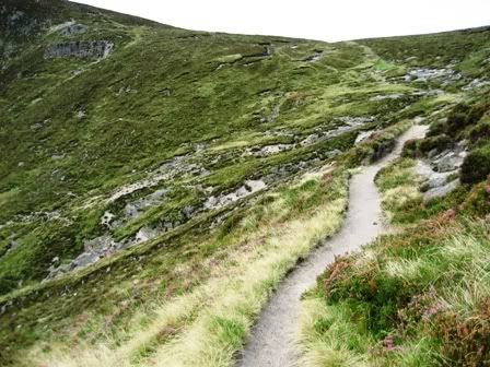
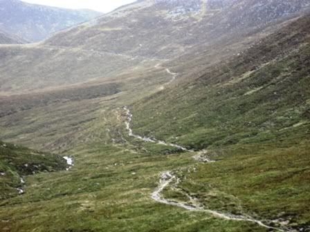
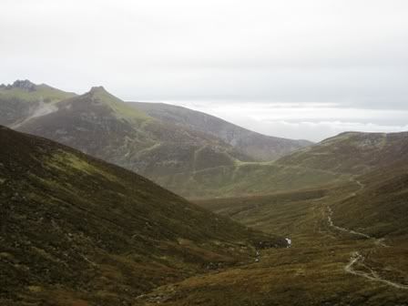
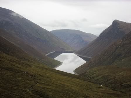
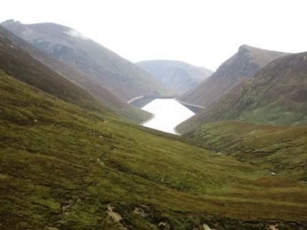
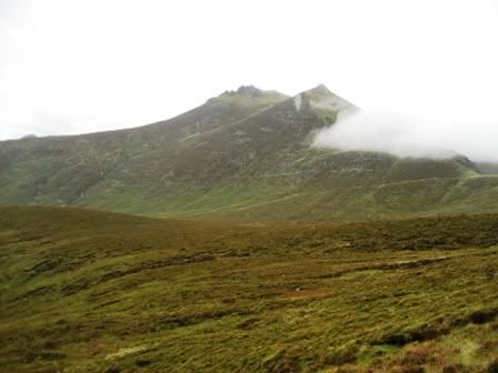
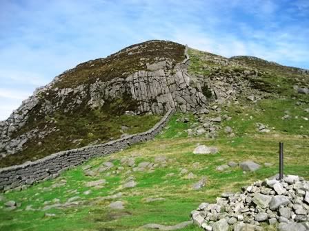
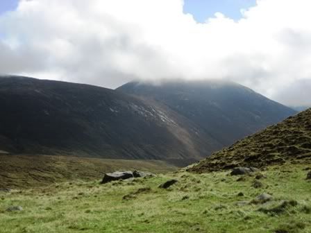
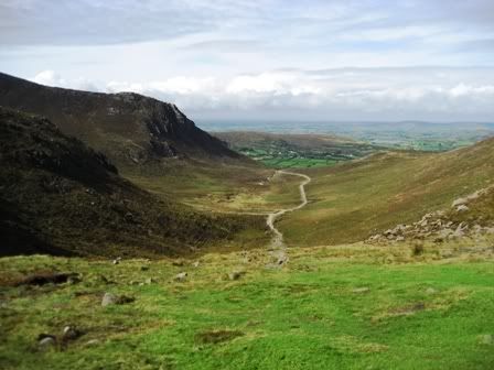
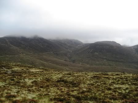
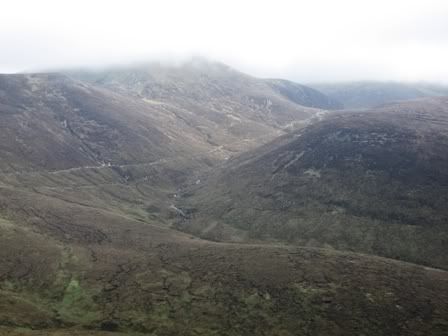
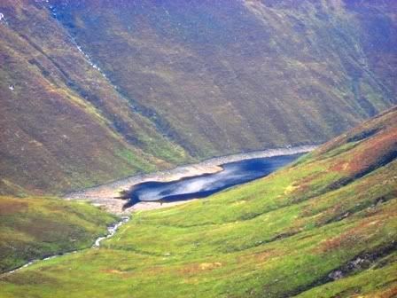
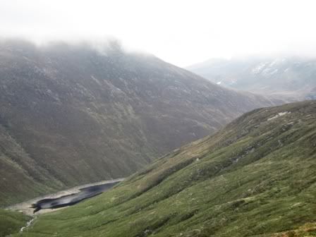
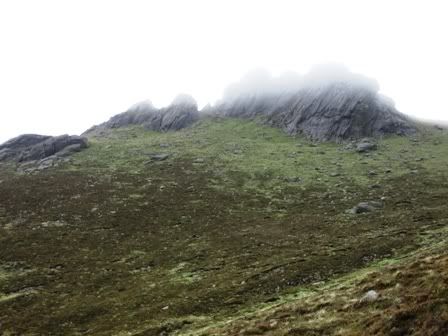
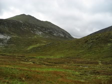
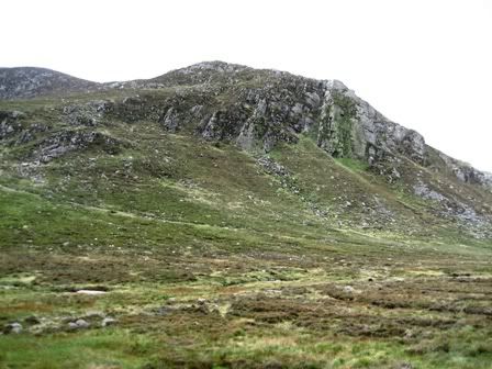
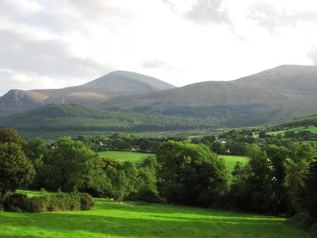
The popular song has made the Mournes the best known mountains in Ireland. Distinctive and self contained, they are tucked away in the south east corner of Northern Ireland, with 12 shapely summits rising above 2,000 ft on the eastern side.

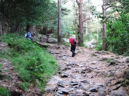
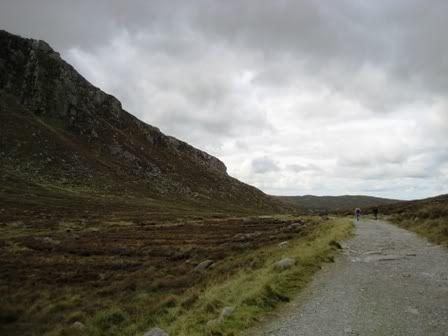
The mountains of Mourne are one of the most picturesque mountain areas in Ireland. Uniquely for a mountain range, most of the summits are grouped together in an area only seven miles broad. Both the Mournes northern boundary at Newcastle and southern at Rostrevor are distinguished by steep slopes which dominate the coast. The mountain area remains uninhabited and without roads preserving the quality of uspoiled wilderness. Miles of winding paths, many of them old quarry tracks, lead high through the hills and make it possible to discover and enjoy their spectacular scenery.

取自:http://www.mournelive.com/


事前须知事项:

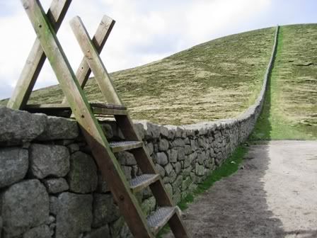
When going for a walk, particularly in a mountainous or very rural area and for medium and long distance walks, it is important to take safety precautions.

1. Clothing

Apply sensible comfortable clothing. Wear a number of layers for warmth
Waterproof/windproof outer jacket
Comfortable footwear with a good grip
Hat and gloves
Spare warm clothing

2. Suggested Equipment

Watch
Sun block
Map and compass and / or a Global Positioning System (GPS) and spare batteries
Food and water or a warm drink - avoid alcohol
Some extra energy-giving food and emergency rations
Large polybag/survival bag
Whistle and torch
First aid kit

N.B. Mobile phones are useful but have their limitations as the reception is very variable in mountainous or very rural areas.

3. Before the walk

Know how to use your map and compass
Get a weather forecast
Plan your route to suit the time available, the weather and the capabilities of the group
Leave clear details of your intended route and estimated time of return

4. On the walk

Consuming alcohol on a walk can reduce your ability to retain body heat and can impair your judgment
Know where you are at all times and be able to give a grid reference
In an emergency. Ring 999 and ask for mountain rescue.
Keep together as a group

取自:http://www.walkni.com/UsefulWalkingInfo.aspx?ID=12

[ 本帖最后由 xijiayu 于 25-9-2007 12:17 AM 编辑 ]
回复

使用道具 举报

 楼主| 发表于 24-9-2007 03:36 AM | 显示全部楼层
简介:

Mourne Mountains位于北爱东南部的County Down,是由12座山峰组成。要是你到Mourne Mountains走一趟,你就会了解为什么当初William Percy French (1854 - 1920)的歌曲[Mountains of Mourne]里有一段歌词会写道:Where the Mountains of Mourne sweep down to the sea。

更多关于Mourne Mountains的旅游质询可参考:

http://www.walkni.com/Default.aspx

http://www.mournelive.com/

旅途:

20/9-22/9/2007到Mourne Mountains,在海边小镇Newcastle小住两晚。这个Newcastle是个宁静的小镇,也是所有有意探索Mourne Mountains之奥秘的爬山客,探险家,或普通游客必到之处。虽然镇上只有一条数百米长的商业大街,但靠海的公寓,B & B,和度假屋比比皆是,甚至拥有一间五星级的resort和spa饭店(Slieve Donard)。

在还未抵达小镇前,在巴士内已经可以看到那庞大的Mourne Mountains群山。Newcastle的[靠山]是Slieve Donard,Shan Slieve和Slieve Commedagh这三座大山(Slieve原自爱尔兰语sliabh,意思是山)。从镇内的任何角落,都可以看到它们的雄伟的山影。


第一天抵达后,到hostel卸下包袱,我就拿着Mourne Mountains的地图,换上登山装备,去寻找北爱第一山峰,853m的Slieve Donard。


我从Donard Park停车场出发,那里也是多数登山客要攀登Slieve Donard的出发点,沿着Glen River慢慢登山,途中经过Donard Wood Forest。对于没有自己交通的登山客来说,也是最方便的地点,因为就离Newcastle镇步行5分钟而已。另一个出发点是从比较南边的Bloody Bridge,沿着Slieve Donard和Slievenagarragh间的Bloody Bridge River而上。

我在停车场那里遇到两个英国人父子John和Bryan,询问他们上山的方向。正巧也遇上他们也要登山,就与他们结伴同行。他们到过这里好多次,在有熟悉环境地理的人带路,我也不用担心迷失方向。


一路山,我们沿着Glen River上山,通过树林和岩石步道。约30分钟后,我们到达半山,穿过绿荫,迎来另外一个世界。


[ 本帖最后由 xijiayu 于 25-9-2007 12:18 AM 编辑 ]
回复

使用道具 举报

 楼主| 发表于 24-9-2007 03:37 AM | 显示全部楼层
沿着Glen River,行走在Slieve Donard和Shan Slieve间的山谷(valley)。


回头一望Donard Wood Forest和Newcastle的海边。


早上山上的登山客不多,到处只有绵羊群。


离开城镇的喧闹,我向往宁静的山谷,听着小溪的水流声,山中的鸟声,行走在绵羊群旁,仿佛你是这世界上唯一一个在探索这片大自然的人类。这就是我风尘仆仆离开闹市到Mourne Mountains的用意了。

-待续-


北爱 秋
23/9/2007 2013
回复

使用道具 举报

 楼主| 发表于 24-9-2007 11:53 PM | 显示全部楼层
到达半山上,看见Mourne Wall。那是长达22 miles连接每座山峰的小长城,是由北爱水利局兴建。在Mourne Mountains的深山谷里,有两个集水区(Resevoir),分别为Ben Crom和Silent Valley。它们每天提供Belfast超过三千万加仑的自来水。


沿着Mourne Wall的左边而上,就到达Slieve Donard。


我们先到Slieve Commedagh和Shan Slieve,然后在回程时,我会自己再去Slieve Donard。爬上Slieve Commedagh途中,拍摄对面的Slieve Donard。


Mourne Mountains内的其它山峰。


回复

使用道具 举报

 楼主| 发表于 24-9-2007 11:53 PM | 显示全部楼层
Annalong River。


在我计划中的Slieve Bearnagh。


望向Newcastle。


山上的羊群和其它生物。


最终在Slieve Donard山顶上拍摄的风景。


回复

使用道具 举报

 楼主| 发表于 24-9-2007 11:54 PM | 显示全部楼层
Slieve Commedagh。


之后,我沿着上山的路线下山。


半山上Forest Park的植物。


回复

使用道具 举报

 楼主| 发表于 24-9-2007 11:54 PM | 显示全部楼层
常见的圣诞节装饰叶子。


回到Newcastle镇,刚下起雨,我撑着伞,慢步走回hostel。


在镇内看Slieve Donard。


夜晚的小镇非常宁静。吃过晚餐后,我回hostel休息,养足精神,预备好明天的行程。


由于是工作日,hostel内比较少住客,因此我都是一个人霸占整个六人房。在hostel房间里,可以透过落地窗看海边和小镇的夜景。明天,我打算直捣Mourne mountains心脏地带,Ben Crom和Silent Valley。由于Silent Valley距离这里有一段相当远的距离,我看了地图,打算再沿着Glen River的路线上山,然后沿着Brandy Pad,先到Slieve Bearnagh,再到Silent Valley。保守估计要至少十个小时,然后傍晚在从南边的Kilkeel镇搭车回来。

-待续-


北爱 秋
24/9/2007 1551
回复

使用道具 举报


ADVERTISEMENT

 楼主| 发表于 26-9-2007 01:12 AM | 显示全部楼层
次日(21/9/2007)清晨一早就起床。用过早餐后,我于八点就再往山区闯。我还是选择跟昨天同样的路线上山,一来Donard Park最靠近Newcastle,二来我已熟悉这条路线。因此,上山自然不费多少时间,正所谓熟能生巧,脚步自然比昨天快得多了。

这一早,山上没有半个人影,也许是因为昨晚刚下过一阵雨,或许是时间还早。我感觉比昨天舒服多了,空气里含着早晨的清新水气。除了Glen River的水流声,林间的绵羊和鸟声,整座山是非常宁静的,好像我是山中唯一的人类。

今天的路线是越过Slieve Donard和Slieve Commedagh间的Mourne Wall,然后一路沿着Brandy Pad,北上到Slieve Bearnagh,然后再沿着Ben Crom回到Silent Valley。

这是连接南北的山谷,Annalong Valley,Brandy Pad必经之地。


行走在Brandy Pad。


这是一条在18和19世纪,人们走私烟酒等货品的路线(Smugglers' route)。当时的人为了逃过北爱的海关检查,常将货品从Isle of Man海运到南面的海岸,上岸后就直接进入Mourne Mountains山区,用驴子在夜间通过此通道,把货物运到Mourne Mountains北部的Hare's Gap,然后转往内地各地。而这条由南到北穿越Mourne Mountains的通道,自然就被称作Brandy Pad(取名Brandy酒品牌),也广泛地被人称呼到现在。

从Brandy Pad慢慢通往远方的Slieve Bearnagh。


途中可以看到Mourne Mountains心脏地带内的蓄水区。这个是北部的Ben Crom,它里面的水会流进南部的Silent Valley蓄水区。我从Brandy Pad拍摄Ben Crom。


回复

使用道具 举报

 楼主| 发表于 26-9-2007 01:12 AM | 显示全部楼层
最终到达北方的Slieve Bearnagh。这是座双峰山 (Slieve Bearnagh也可以翻译成gapped mountain,意思是twin peak),也是行内登山爱好者认为Mourne Mountains中拥有最漂亮景色的山峰。


在Mourne Mountains北部的[大门]Hare's Gap拍摄的景色。


Trassey Track,是Brandy Pad以北的延续,也是许多要登上Slieve Bearnagh的登山客从北部的起点。另一个起点是从南方一直沿着Brandy Pad到此。


我登上Slieve Bearnagh,在半山上拍摄刚才经过的Brandy Pad。


黑色的Ben Crom蓄水区。Ben Crom里的水会流到南部的Silent Valley蓄水区。


Slieve Bearnagh的绝顶。

回复

使用道具 举报

 楼主| 发表于 26-9-2007 01:15 AM | 显示全部楼层
那时登Slieve Bearnagh,我竟然在半山迷失了。前方的步道突然消失,山上又起雾,面对上下都是斜坡的情况下,真是顿时进退两难。从上山到现在,真是一个人影都没见到,自己也没有指南针和手机,心想只有靠自己慢慢在寻找出路。

我决定立刻往上山的方向回返,这样能避免越行越远。我拿着地图凭地形和自己的方向感,判断可能的路线,在一个小时后,终于回到登山起点Hare's Gap,再沿着Mourne Wall旁的斜坡慢慢爬上。这时候,听到半山上传来登山客谈话的声音,就去寻找他们问路。

遇到三个登山客,从Slieve Bearnagh下来,这是我今天在山上首次遇到人类。从他们那里打听到,如果要从这里沿着Ben Crom和Silent Valley往南边走,需要5-6小时才能走出山区。而在Silent Valley没有公共交通能回到Newcastle,必须另外步行2-3小时,才能到达南部的小镇Kilkeel,在那里才能搭40分钟的巴士回到Newcastle。

我心想不妙,因为到时候天色也渐渐黑暗,消微再走错路,我就得在山中度过难熬的一夜了。因此决定跟他们一同由北方的Hare's Gap经Trassey Track离开山区,再由Tollymore Forest Park一路回去Newcastle。这是目前最快的方式了。

走在Brandy Pad,前往Trassey Track的路上。这是北Mourne Mountains的景色。


离开Trassey Track,跟三名登山客道谢后,我就沿着Tollymore Forest Park回Newcastle。一路上经过的是许多的温带树林,还有Tollymore River。


回复

使用道具 举报

 楼主| 发表于 26-9-2007 01:15 AM | 显示全部楼层
这个Forest Park非常大,但里面的景色很漂亮。


走出Tollymore Forest Park,来到Bryansford镇,距离Newcastle约2-3 miles。我沿着通往Newcastle的乡间道路,一路回Newcastle。沿途拍摄的Mourne Mountains北方景色。


回到Newcastle,已经是超过傍晚6时。走了10个小时的山路,我的双脚已经由麻痹到酸痛。这可是我毕生中一天内走过最远的路的一次。


已经疲惫不堪的我,打算直接到hostel旁的超商买些ready made meal,拿回宿舍热了就当晚餐了。我已经没有多余的力气去寻找餐厅吃饭了。


在宿舍里的厨房,热了晚餐,就这样解决了。


晚间精疲力尽,很早就睡了。明天恐怕无法再上山了,因为双脚今天已经overdone。只是遗憾无法到Silent Valley一趟。


北爱 秋
25/9/2007 1753

ps:关于Silent Valley的起源:

自从山谷被开辟成为蓄水区后,山谷里的鸟儿就突然消失了。因此,原本可以听见鸟儿声的美丽山谷,顿时消音。Silent Valley的名字就起源于此。以下是从http://www.walkni.com网站得到的Silent Valley的照片。

回复

使用道具 举报

您需要登录后才可以回帖 登录 | 注册

本版积分规则


ADVERTISEMENT


ADVERTISEMENT


ADVERTISEMENT

ADVERTISEMENT


版权所有 © 1996-2023 Cari Internet Sdn Bhd (483575-W)|IPSERVERONE 提供云主机|广告刊登|关于我们|私隐权|免控|投诉|联络|脸书|佳礼资讯网

GMT+8, 20-4-2024 10:21 PM , Processed in 0.057105 second(s), 21 queries , Gzip On.

Powered by Discuz! X3.4

Copyright © 2001-2021, Tencent Cloud.

快速回复 返回顶部 返回列表